I can’t tell you how many times it’s happened: I’ll be on the Canal Street ferry riding home toward the West Bank, and a tourist will point across the river and ask me, “So what’s on this island?” It’s a head shaker, but I guess from that vantage my neighborhood does look a little like an island, with the Crescent City Connection at one end and water wrapping around the land at the other. I explain gently that it’s the other side of the Mississippi River and it’s still New Orleans, which typically prompts the surprised follow-up question, “People live there?” It’s funny, but that’s ok with me.
I like that my neighborhood, Algiers Point, only one year younger than the French Quarter, is still a bit of a secret. 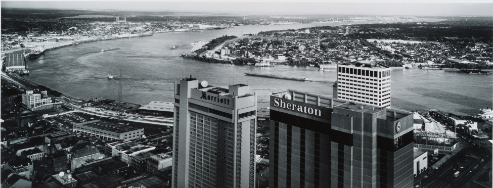
No, it's not in island, but this image by Michael A. Smith does suggest how people could get confused. Algiers is pictured here in 1985, across from the bustling CBD and French Quarter. (THNOC, ©Michael A. Smith, 1986.125.370)
New Orleanians are loyal to their neighborhoods, and I’m no exception. My husband and I moved to New Orleans in 1995, settling in Algiers Point, and we’ve never lived anywhere else. It’s always felt like an escape from French Quarter chaos, a sanctuary. Especially now, during this period of distance and isolation, it really is my safe place. Everyone has their own way of dealing with the stress and anxiety of the pandemic; I know a person who prefers to stay busy indoors and not go out, another who always likes to be super connected and know what’s happening. For me, I need to get Out. Of. The. House. This is where my neighborhood saves me.
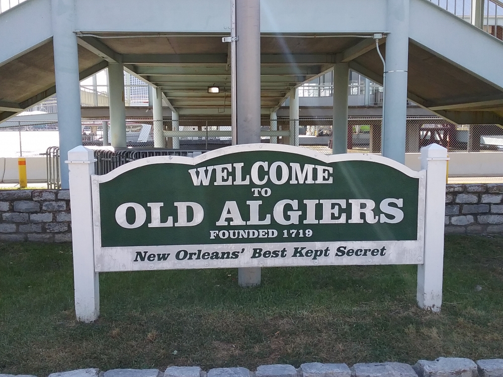 A sign welcomes visitors to Algiers Point. (Photo by Keely Merritt)
Every day I take my dog or jump on my bike and head for the levee, often taking my camera with me. It’s easy to keep a good distance from others; I can breathe, look at the sky, and wave at friends. For a short time I can pretend that things are normal. And, as great as it is to clear the cobwebs and get some exercise, there is history to be learned on the levee as well!
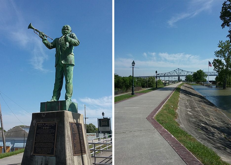 A statue of Louis Armstrong welcomes walkers to the Robert E. Nims Jazz Walk of Fame. (Photo by Keely Merritt)
Heading upriver from the Algiers ferry landing, you’ll run right into a big, tall statue of Louis Armstrong. This is the beginning of the Robert E. Nims Jazz Walk of Fame, a line of lampposts on the levee extending all the way to the bridge. On about every third one hangs a sign with the name of a jazz legend, accompanied by a short bio and a picture. You’ve probably heard of Sidney Bechet and Buddy Bolden, but what about Papa Celestin or the Boswell Sisters?
Moving downriver on the levee from the ferry landing, remember to look down occasionally to find the plaques that the Algiers Historical Society has installed in the pavement. It’s like a plaque scavenger hunt, each one giving you a tiny bit of history about the place where you are standing. The first one, just past the ferry, tells how Algiers was once a holding place for newly arrived captive Africans, before they were taken across the river for auction. (See more in The Collection’s virtual exhibition Purchased Lives: New Orleans and the Domestic Slave Trade, 1808–1860.)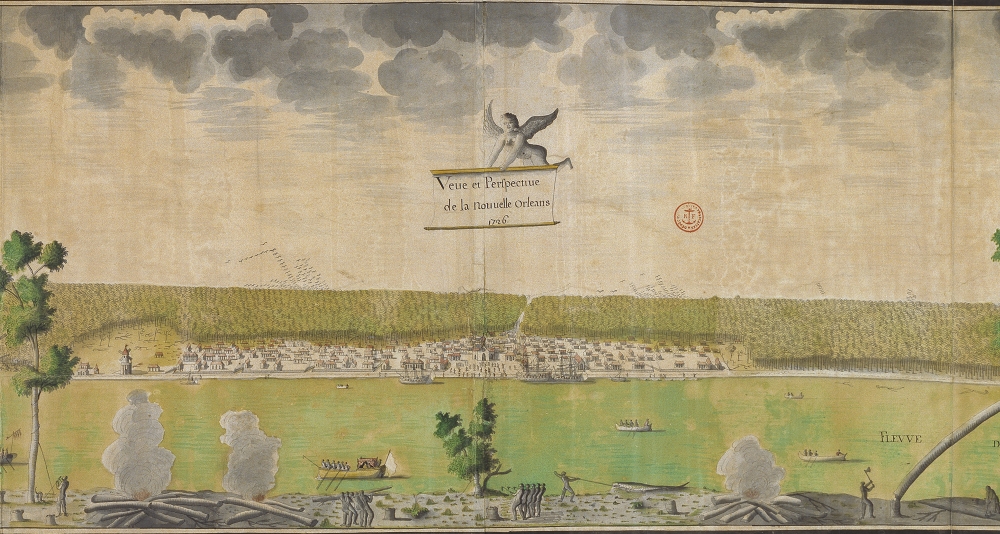 A 1726 illustration shows the fledgling city of New Orleans across the Mississippi River with Algiers in the foreground. Enslaved laborers are pictured chopping and carrying wood in Algiers. (By Jean Pierre Lassus; Courtesy of the Archives nationales d'outre-mer, Aix-en Provence, France)
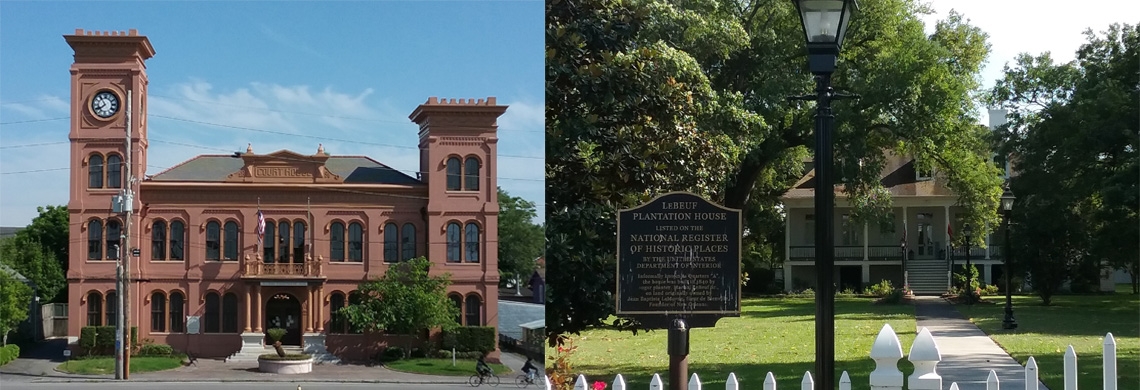
Soon you’ll see the old Algiers Courthouse facing the river and learn that it is the former site of the Duverjé Plantation, built starting in 1812 and destroyed, along with 200 other structures, in the great fire of 1895. Farther along, the plaque marking the site of the former Verret Plantation says that nearby Whitney Avenue was originally a canal and that the pirate Jean Lafitte used it to reach New Orleans from Barataria Bay. I love that Lafitte was a West Banker! 
The Algiers Courthouse stands at the former site of the Duverje Plantation, which was destroyed by fire in 1895. (Photo by Keely Merritt)
Then we come to the plaque for the US Naval Station, Algiers, established in 1901. It started out as a dry dock for ship repair and has varied in function over the years. After World War II, the area was designated Naval Support Activity New Orleans and served nearly 4,000 active-duty navy and Marine Corps personnel until 2011, when the naval base closed. Now known as Federal City, the complex still houses the local headquarters of the Marine Corps Reserve and the US Coast Guard. It also features the historic LeBeuf Plantation House, built in 1840 in the French Creole style and now a private residence. 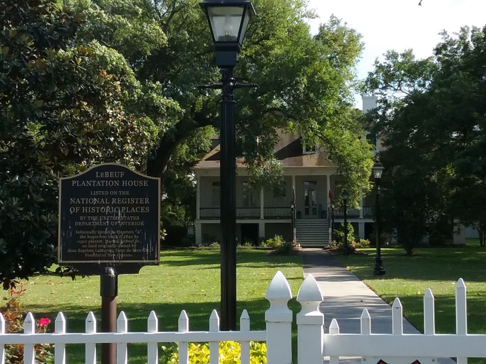
The historic LeBeuf Plantation House was built in 1840 in the French Creole style and is now a private residence. (Photo by Keely Merritt)
Nearby is one more plaque, where the Southern Pacific Railroad Yards used to be. There, railroad cars were ferried across the river, and the site has remnants of old wooden structures with track, where the train car would connect from land to ferry. 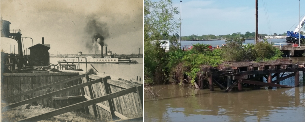
A 1916 photograph (left) shows the Southern Pacific Railroad landing in Algiers. Merrit's image (right) shows the remaining pilings from the structure. (THNOC, gift of Mr. and Mrs. Peter Bernard, 1984.112.221; Photo by Keely Merritt)
This is usually where I turn around, where the paved part of the levee ends and turns to gravel. I have a friend who walks early in the morning and continues past this point. The other day she kept going all the way to the Chalmette ferry landing! Well, food for thought—maybe next time. For now, it’s time to head home. History lesson over, and I’m counting how many turtles I see. One day it was 14, and they were not social distancing. I ride past people catching big fat catfish and yeah, they’re going to eat ‘em. And so many water birds—egrets, herons, anhingas, and colorful ducks I’ve only seen before as carved decoys! But here I am, back at the house. Better go wash my hands.
Now it's your turn!
Take a walk around your neighborhood and show us the history you find, by tagging posts with #NolaNeighborhoodCurators. What do you see? What changes and what stays the same? Look closely at the buildings, street names, geography, or even plants; almost everything in New Orleans has a backstory. If you're curious to know something about the history around you, send a note to our Virtual Reading Room. They handle research requests big and small, and they'll do what they can to satisfy your curiosity.
Tag posts with #NolaNeighborhoodCurators to be featured on our Facebook, Twitter, and Instagram pages, or in future articles like this one.

