


Databases
Find primary sources, land records, and newspaper archives related to colonial Louisiana, the French Quarter, arts and culture, and more.

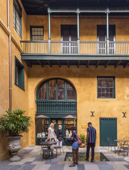
Vieux Carré Survey
HNOC’s Collins C. Diboll Vieux Carré Digital Survey contains detailed property data about every building and lot in the French Quarter from the French colonial period to the present. Begun in 1960 to bolster local historic preservation efforts, the survey incorporates maps, major site plans, old drawings, engravings, sketches, paintings, newspaper clippings, property records, and more.

Lost Friends
For decades following the end of the Civil War, people placed personal ads to find family members lost in slavery. They ran in a column called Lost Friends in the Southwestern Christian Advocate.The Lost Friends database provides access to more than 2,500 of these advertisements, searchable by name, year, and location.

New Orleans Cemetery Database
Created in collaboration with Tulane University and Save Our Cemeteries, the New Orleans Cemetery Database provides digital access to data contained in the Survey of Historic New Orleans Cemeteries, which covers St. Louis No. 1 and St. Louis No. 2. Entries include names engraved on tombs, historical and contemporary condition reports, and photographs.

Decorative Arts of the Gulf South
The Decorative Arts of the Gulf South (DAGS) research project at HNOC is dedicated to documenting and sharing information about antiques and material culture in the Gulf South. Formerly known as the Classical Institute of the South (CIS), the DAGS program takes scholars on fieldwork trips and onsite cataloging intensives to study items made or used in Louisiana, Mississippi, and Alabama from the 18th century through the Civil War.

Louisiana Digital Library
As a member of the Louisiana Digital Consortium, HNOC contributes to the Louisiana Digital Library (LDL), a hub for digitized historical images and artifacts from institutions across the state.

Artist Database
The Artist Database is an index of files on more than 15,700 artists and art organizations that were or are active in New Orleans and the surrounding region. Information from the Collection's publication Encyclopedia of New Orleans Artists 1718–1918 is also contained within the database.

Guide to French Louisiana Manuscripts
This online guide details documents concerning the French experience in Louisiana from the earliest days of the colony up to statehood. It is an online version of Nancy Miller Surrey’s 1926 publication Calendar of Manuscripts in Paris Archives and Libraries Relating to the History of the Mississippi Valley to 1803. The database also provides a list of links to archival institutions in North America and France, and well as related electronic resources.

Guide to Louisiana Resources in Spain
This extensive guide provides information about Louisiana-related holdings in Spanish archives. Entries cover 20+ repositories, including institutional information, detailed descriptions of relevant holdings, and suggestions for researchers. The guide is available as a PDF in both English and Spanish. Compiled by Guadalupe Fernández Morente and Esther González Pérez.

Spanish Land Grants Archive
The Spanish Louisiana Land Grants Virtual Archive brings together over a thousand documents—grants, surveys, and acts of sale—created by numerous Louisiana surveyors between 1767 and 1840. Written in Spanish, French, English, or sometimes in a mixture of two or three languages, these archives are evidence of Louisiana’s cultural past. The surveys document each recorded party’s place in society (e.g., widow, free person of color, Native American), illustrate the relationship of the land to adjacent and nearby bodies of water, and often indicate the types of flora found in the vicinity of the measured parcels.

Colonial Louisiana Bibliography Database
The Bibliography of Colonial Louisiana aims to be an essential guide to available published resources on colonial Louisiana (1682–1803) covering works published between 1900 and the present day. It contains citations of books, book chapters, articles, conference papers, printed documents, facsimile editions of manuscripts, and reprints of earlier publications, regardless of language or place of publication.
Online Catalog
Search or browse HNOC’s vast collections of photos, manuscripts, artifacts, books, artwork, and more in our online catalog.

Visit the Williams Research Center
Explore centuries of Gulf South culture with unparalleled access to rare documents, art, and historic treasures. Stop in or browse our online catalog.

Ask a Librarian
Have a question about our holdings, or need more information about visiting the Williams Research Center? Our reference staff wants to hear from you.
Subscribe to Our Newsletter
