


The District
In 1897 Alderman Sidney Story introduced a city ordinance, which would go into effect the following year, designed to isolate prostitution to a vice district just north of the French Quarter. This area became known as Storyville, to Story’s dismay, but most of the neighborhood’s inhabitants, employees, and visitors simply referred to it as the District. Even though Storyville was not the country’s first legally designated red-light district or its first attempt to regulate prostitution, the neighborhood’s notoriety has lingered longer than most. Storyville became a financially successful entertainment mecca, attracting white men of means from around the country as part of the city’s emerging winter tourism economy. Concurrently, a separate red-light district for African American patrons—known as Uptown, or Black, Storyville—operated quasi-legally near the site of today’s city hall. All told, the history of Storyville encompasses a tangle of themes, including prostitution, music, money, racial identity, segregation, drug and alcohol abuse, violence, displacement, and racial and sexual exploitation.
Twenty years into the experiment, the District was in a state of decline, facing pressures from social and political changes sweeping the nation, including the country’s entry into World War I. In 1917 the federal government prohibited open prostitution within five miles of any military installation, forcing the closure of red-light districts across the nation. The curtain fell on Storyville on November 12, 1917. That same year, the Original Dixieland Jazz Band, a group of white musicians from New Orleans, recorded what is considered the first jazz record. Featuring “Livery Stable Blues” and “The Original Dixieland Jass Band One-Step,” the record was released by Victor and quickly became an international hit, contributing to the spread of New Orleans jazz music that presaged the Jazz Age.


A Changing Neighborhood
Situated in the city’s Fourth Ward, the approximately ten square blocks that defined Storyville extended from the uptown side of Customhouse (now Iberville) Street to the uptown side of St. Louis Street, and from the lake side of Basin Street to the river side of North Robertson Street. In the fifteen years or so before it was designated as a vice district, the area was both residential and industrial. Home to a largely working-class population that was primarily African American, the neighborhood was dotted with small wooden houses, a firehouse, a school, and a church. These structures coexisted with Wood’s Cotton Press, which dominated most of three square blocks along Canal Street from Claiborne Avenue to Marais Street; L’Hote and Company lumber factory and yard near the Old Basin Canal; and two breweries. Major landmarks flanking the area included St. Louis Cemeteries Nos. 1 and 2, the Old Basin Canal, and the Spanish Fort and Lake Railroad line, which ran from Canal Street down Basin Street for two blocks before turning north on Bienville Street toward Lake Pontchartrain.
By 1908, the midpoint of Storyville’s existence, there was more commercial development along the perimeter of the District, including a bottling plant, a cement block manufactory, and a fire extinguisher factory. The grand terminal building of the interstate Southern Railroad had opened at Canal and Basin Streets. Within the neighborhood, saloons, brothels, and dance halls abounded, supplanting the residential properties of the previous era. Rising rents had driven out most of the neighborhood’s residents, and after years of declining membership, the church, the Union Chapel Methodist Episcopal Church, closed in 1914.


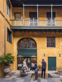
Street Scenes
Though taken after the official end of Storyville, these photographs provide a glimpse into the physical landscape of the neighborhood.


